Pettycrate Lane
Introduction
The photograph on this page of Pettycrate Lane by Hugh Craddock as part of the Geograph project.
The Geograph project started in 2005 with the aim of publishing, organising and preserving representative images for every square kilometre of Great Britain, Ireland and the Isle of Man.

There are currently over 7.5m images from over 14,400 individuals and you can help contribute to the project by visiting https://www.geograph.org.uk
Pettycrate Lane
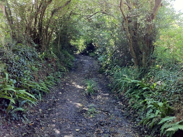
Image: © Hugh Craddock Taken: 9 Sep 2014
Pettycrate Lane a short distance above the last dwelling served by the lane. Between there and Langdon Lane, Pettycrate Lane has become overgrown from above, and although at the time of writing, it's perfectly passable on foot, it would be tricky on horseback, and the broken stone surface unpleasant for cycling. However, the lane remains an unsealed public road.
Images are licensed for reuse under creativecommons.org/licenses/by-sa/2.0
Image Location


Leaflet Map data © OpenStreetMap
Latitude
50.729557
Longitude
-2.824847