Church of All Saints, South Leverton
Introduction
The photograph on this page of Church of All Saints, South Leverton by Alan Murray-Rust as part of the Geograph project.
The Geograph project started in 2005 with the aim of publishing, organising and preserving representative images for every square kilometre of Great Britain, Ireland and the Isle of Man.

There are currently over 7.5m images from over 14,400 individuals and you can help contribute to the project by visiting https://www.geograph.org.uk
Church of All Saints, South Leverton
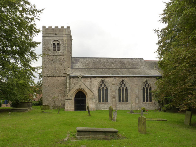
Image: © Alan Murray-Rust Taken: 3 Sep 2014
View from the south showing the 12th century Norman tower and the early Decorated period south aisle of around 1300. The church is Listed Grade II*.
Images are licensed for reuse under creativecommons.org/licenses/by-sa/2.0
Image Location


Leaflet Map data © OpenStreetMap
Latitude
53.320951
Longitude
-0.825553