Energy infrastructure
Introduction
The photograph on this page of Energy infrastructure by Lairich Rig as part of the Geograph project.
The Geograph project started in 2005 with the aim of publishing, organising and preserving representative images for every square kilometre of Great Britain, Ireland and the Isle of Man.

There are currently over 7.5m images from over 14,400 individuals and you can help contribute to the project by visiting https://www.geograph.org.uk
Energy infrastructure
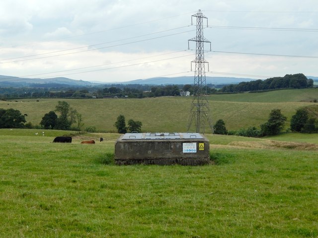
Image: © Lairich Rig Taken: 25 Aug 2014
The picture was taken from the road; there was an orange gas pipeline marker there, and a couple of smaller markers. The structure in the foreground is part of the same gas network. The course of the power lines in the background is marked on the map. The building almost directly behind the pylon is Easter Drumquhassle Cottage (Image); to the left of that are the roofs of the buildings of Easter Drumquhassle Farm (Image). The left end of the concrete structure (gas network) is useful as a reference in what follows: the point on the skyline directly behind that edge marks a dip in the skyline hills. About halfway between that dip and the left edge of the picture is Pappert Hill (Image, 6 miles, 9.5 km). To the right of that dip is Carman Hill (Image, 9 miles, 14.5 km) and the range of muirs that extend NNW from it. A small part of Ben Bowie (Image, 10 miles, 16 km) is at the far right.
Images are licensed for reuse under creativecommons.org/licenses/by-sa/2.0
Image Location
Latitude
56.058655
Longitude
-4.41967