Hotbank and Crag Lough
Introduction
The photograph on this page of Hotbank and Crag Lough by Karl and Ali as part of the Geograph project.
The Geograph project started in 2005 with the aim of publishing, organising and preserving representative images for every square kilometre of Great Britain, Ireland and the Isle of Man.

There are currently over 7.5m images from over 14,400 individuals and you can help contribute to the project by visiting https://www.geograph.org.uk
Hotbank and Crag Lough
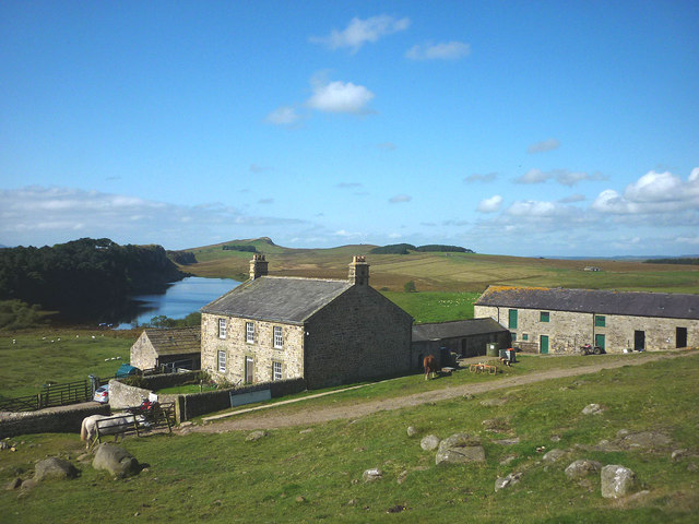
Image: © Karl and Ali Taken: 2 Sep 2014
A typically sturdy Northumbrian farmhouse in an iconic location just north of the line of Hadrian's Wall. Crag Lough, below the shadowed ramparts of Highshield Crags, is owned by the National Trust. Just above the left-hand chimney of the farmhouse is Winshield Crags (345m), the highest point of the Wall.
Images are licensed for reuse under creativecommons.org/licenses/by-sa/2.0
Image Location
Latitude
55.007656
Longitude
-2.357391