Path above Woodstock Road
Introduction
The photograph on this page of Path above Woodstock Road by Lairich Rig as part of the Geograph project.
The Geograph project started in 2005 with the aim of publishing, organising and preserving representative images for every square kilometre of Great Britain, Ireland and the Isle of Man.

There are currently over 7.5m images from over 14,400 individuals and you can help contribute to the project by visiting https://www.geograph.org.uk
Path above Woodstock Road
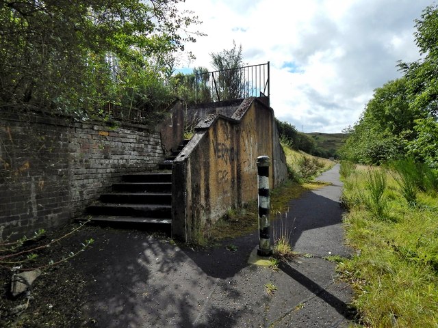
Image: © Lairich Rig Taken: 18 Aug 2014
Compare another picture Image; the path, though not visible in that photograph, is parallel to the road, and is at the top of the grassy bank to the right (south) of the road, between that bank and the trees. The path and the steps that appear in the present picture now serve no useful purpose (the steps lead nowhere, and the path merely leaves and rejoins the pavement). However, another view of the road, similar to the one linked above, but taken a few years earlier, shows buildings that used to stand here: Image The path and the steps were associated with those buildings.
Images are licensed for reuse under creativecommons.org/licenses/by-sa/2.0
Image Location
Latitude
55.939182
Longitude
-4.778622