Brothock Burn
Introduction
The photograph on this page of Brothock Burn by Anne Burgess as part of the Geograph project.
The Geograph project started in 2005 with the aim of publishing, organising and preserving representative images for every square kilometre of Great Britain, Ireland and the Isle of Man.

There are currently over 7.5m images from over 14,400 individuals and you can help contribute to the project by visiting https://www.geograph.org.uk
Brothock Burn
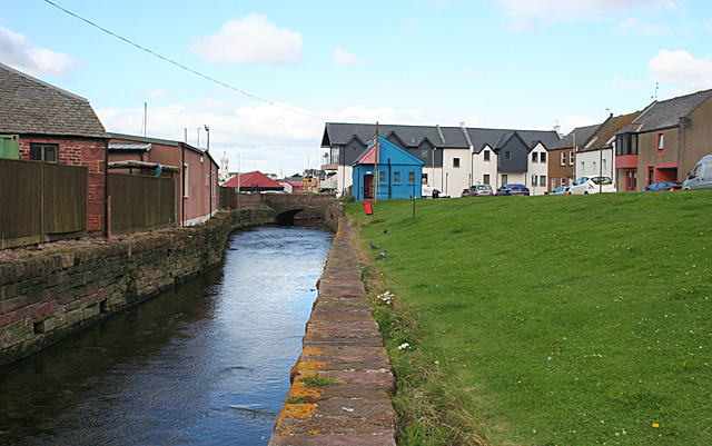
Image: © Anne Burgess Taken: 18 Aug 2014
The burn which gave the town its full original name of Aberbrothock is not a prominent feature of the town, being channelled between walls and in several places culverted. This is the last part of the burn before it reaches the sea. It must have been diverted eastwards because it turns almost 90º beside the harbour and runs parallel to the outer harbour wall here.
Images are licensed for reuse under creativecommons.org/licenses/by-sa/2.0
Image Location
Latitude
56.556104
Longitude
-2.581394