Bishopbriggs Vista
Introduction
The photograph on this page of Bishopbriggs Vista by Raymond Okonski as part of the Geograph project.
The Geograph project started in 2005 with the aim of publishing, organising and preserving representative images for every square kilometre of Great Britain, Ireland and the Isle of Man.

There are currently over 7.5m images from over 14,400 individuals and you can help contribute to the project by visiting https://www.geograph.org.uk
Bishopbriggs Vista
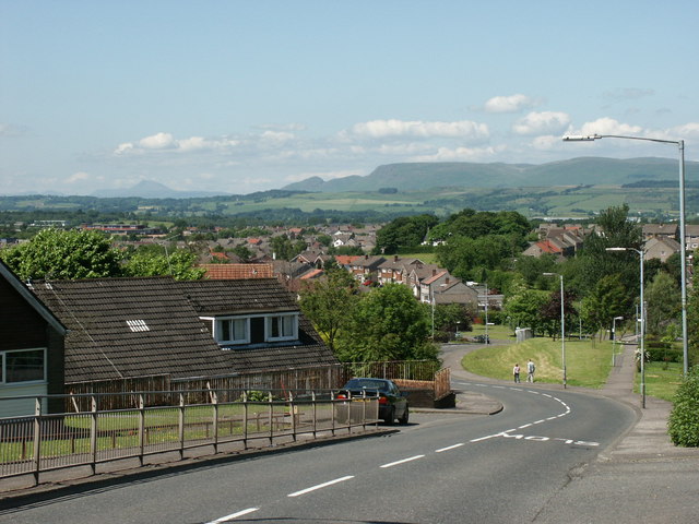
Image: © Raymond Okonski Taken: 16 Jun 2003
Woodhill Road. From this high point in the town, close to the water tower, the views to the distant hills are spectacular. On the horizon are the Campsie Fells, whilst the mountain in the haze on the left-hand side of the picture is the massive bulk of Ben Lomond
Images are licensed for reuse under creativecommons.org/licenses/by-sa/2.0
Image Location
Latitude
55.901262
Longitude
-4.205408