Teddington station
Introduction
The photograph on this page of Teddington station by Robin Webster as part of the Geograph project.
The Geograph project started in 2005 with the aim of publishing, organising and preserving representative images for every square kilometre of Great Britain, Ireland and the Isle of Man.

There are currently over 7.5m images from over 14,400 individuals and you can help contribute to the project by visiting https://www.geograph.org.uk
Teddington station
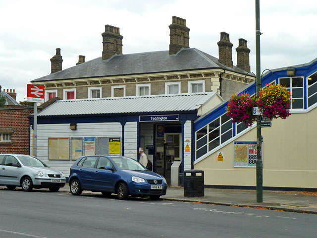
Image: © Robin Webster Taken: 16 Sep 2012
The near entrance with the corrugated roof is directly for the up platform. Beyond, on the other side of the tracks, is the large station building on the down side. In fact, as there is a loop service, Waterloo may be reached in about 41 minutes from the down platform and 38 minutes from the up. These are hardly impressive average speeds of no more than 34 km/h (21 mile/h), thanks to the all stations stopping service.
Images are licensed for reuse under creativecommons.org/licenses/by-sa/2.0
Image Location
Latitude
51.424524
Longitude
-0.33269