View of Pendalar
Introduction
The photograph on this page of View of Pendalar by Jonathan Wilkins as part of the Geograph project.
The Geograph project started in 2005 with the aim of publishing, organising and preserving representative images for every square kilometre of Great Britain, Ireland and the Isle of Man.

There are currently over 7.5m images from over 14,400 individuals and you can help contribute to the project by visiting https://www.geograph.org.uk
View of Pendalar
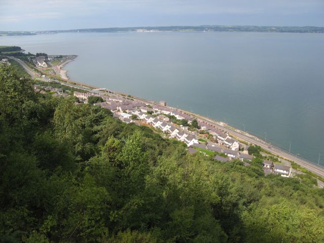
Image: © Jonathan Wilkins Taken: 8 Aug 2014
Looking down from the head of the tramway inclines to Pendalar. A verdant scene of Birch and Ash woodland covering the old screes of quarry waste. As it is high tide, there is no sign of the extensive Lavan Sands which extend most of the way to distant Anglesey.
Images are licensed for reuse under creativecommons.org/licenses/by-sa/2.0
Image Location
Latitude
53.262721
Longitude
-3.964412