Central London from the air
Introduction
The photograph on this page of Central London from the air by Thomas Nugent as part of the Geograph project.
The Geograph project started in 2005 with the aim of publishing, organising and preserving representative images for every square kilometre of Great Britain, Ireland and the Isle of Man.

There are currently over 7.5m images from over 14,400 individuals and you can help contribute to the project by visiting https://www.geograph.org.uk
Central London from the air
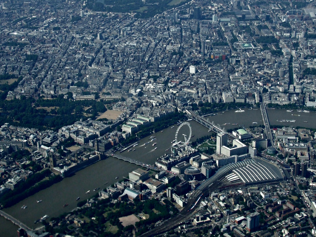
Image: © Thomas Nugent Taken: 30 Jul 2014
The River Thames at Westminster, Houses of Parliament, Big Ben, London Eye, Trafalgar Square, Waterloo railway station and Charing Cross railway station are all visible (as are Euston, St Pancras and King's Cross stations, if you know where to look).
Images are licensed for reuse under creativecommons.org/licenses/by-sa/2.0
Image Location


Leaflet Map data © OpenStreetMap
Latitude
51.500196
Longitude
-0.115975