The Wendover Arm looking west from the Bridge at Drayton Beauchamp
Introduction
The photograph on this page of The Wendover Arm looking west from the Bridge at Drayton Beauchamp by Chris Reynolds as part of the Geograph project.
The Geograph project started in 2005 with the aim of publishing, organising and preserving representative images for every square kilometre of Great Britain, Ireland and the Isle of Man.

There are currently over 7.5m images from over 14,400 individuals and you can help contribute to the project by visiting https://www.geograph.org.uk
The Wendover Arm looking west from the Bridge at Drayton Beauchamp
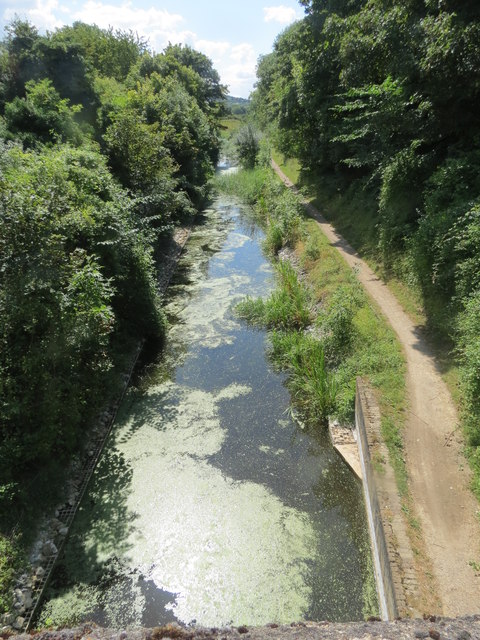
Image: © Chris Reynolds Taken: 3 Aug 2014
This part of the canal was relined when the A41 dual carriageway was built, and vegetation is growing up along the banks and in some places right across the canal. The water runs crystal clear and with plenty of duckweed - but this will change to a muddy soup when canal barges start using it again in a few years time, after a break of over 100 years.
Images are licensed for reuse under creativecommons.org/licenses/by-sa/2.0
Image Location
Latitude
51.798383
Longitude
-0.692512