The Canal Feeder seen from Brentfield Road
Introduction
The photograph on this page of The Canal Feeder seen from Brentfield Road by Marathon as part of the Geograph project.
The Geograph project started in 2005 with the aim of publishing, organising and preserving representative images for every square kilometre of Great Britain, Ireland and the Isle of Man.

There are currently over 7.5m images from over 14,400 individuals and you can help contribute to the project by visiting https://www.geograph.org.uk
The Canal Feeder seen from Brentfield Road
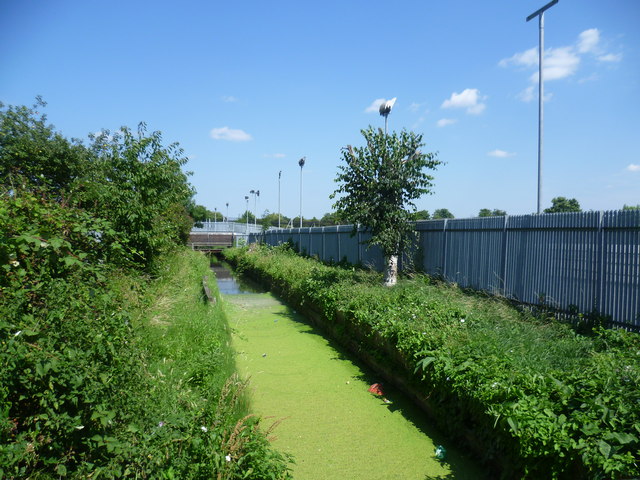
Image: © Marathon Taken: 30 Jul 2014
When the Paddington Canal opened in 1801, the need for water to supply it became and increasingly pressing problem. Aldenham Reservoir, completed in 1795, was not sufficient and nor was Ruislip Lido, completed in the early 1800s. Plans were prepared in 1803 to bring water from the River Brent by creating a reservoir, but the amount and cost of the land required soon put an end to this scheme. However, the idea remained to take water directly from the Brent to the Paddington Canal and after an initial deferment, land was acquired for a canal feeder to run from the Brent at Kingsbury to the canal at Lower Place near Harlesden. The Canal Feeder opened in 1811, but this alone was not enough to solve the problems of water supply, particularly when the Regent's Canal opened eastwards from Paddington in 1820. When the Regent's Canal Company began construction of the Brent Reservoir in 1833, they incorporated the Canal Feeder as the means of taking the water from the reservoir to the canal. At that time it ran through fields and it was only in the 20th century that its present urban setting completely engulfed it. Most of the water required for the canal is now pumped from the Frays and Colne Rivers in Hillingdon, so the Feeder is redundant. Nevertheless the whole length remains intact, although several sections are in covered culverts, and some water still flows from the Brent Reservoir down to the canal. A few sections are accessible but other parts like here can only be viewed from adjacent roads. This is looking in the opposite direction to the flow, towards the Brent Reservoir.
Images are licensed for reuse under creativecommons.org/licenses/by-sa/2.0
Image Location


Leaflet Map data © OpenStreetMap
Latitude
51.547284
Longitude
-0.259411