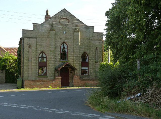
Former chapel, Station Road, Sutton-on-Trent
Introduction
The photograph on this page of Former chapel, Station Road, Sutton-on-Trent by Alan Murray-Rust as part of the Geograph project.
The Geograph project started in 2005 with the aim of publishing, organising and preserving representative images for every square kilometre of Great Britain, Ireland and the Isle of Man.
There are currently over 7.5m images from over 14,400 individuals and you can help contribute to the project by visiting https://www.geograph.org.uk

Image: © Alan Murray-Rust Taken: 24 Jul 2014
The building may have been the 'Independent' Chapel referred to in John Marius Wilson's Imperial Gazetteer of England and Wales of 1870-72. It is dated 1841 on the oval insert. The earliest OS 1:2500 map (c.1875-80) labels the building as 'Institute', then 'Club' on later issues. Now converted to residential use. There is a bench mark http://www.geograph.org.uk/photo/4098857 on the pilaster to the left of the doorway.

