Sutton-on-Trent Holmes
Introduction
The photograph on this page of Sutton-on-Trent Holmes by Alan Murray-Rust as part of the Geograph project.
The Geograph project started in 2005 with the aim of publishing, organising and preserving representative images for every square kilometre of Great Britain, Ireland and the Isle of Man.

There are currently over 7.5m images from over 14,400 individuals and you can help contribute to the project by visiting https://www.geograph.org.uk
Sutton-on-Trent Holmes
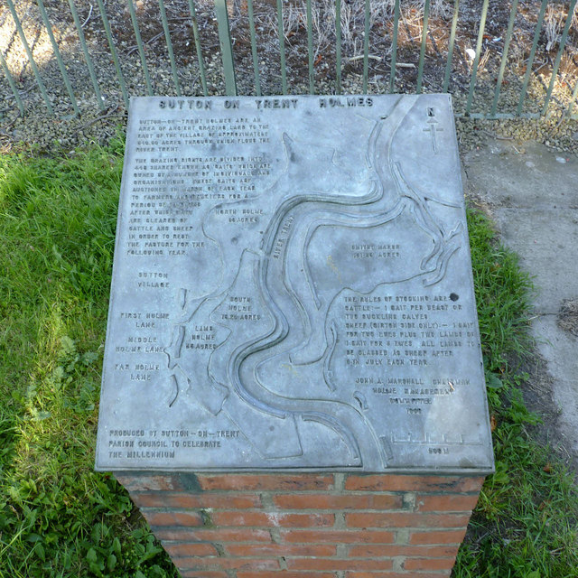
Image: © Alan Murray-Rust Taken: 24 Jul 2014
Cast panel on Main Street describing the Holmes of Sutton-on-Trent. These are the riverside meadows alongside the River Trent which are still grazed under agreements going back to the medieval period. The presence of land on the east bank of the river may well indicate an origin of the tradition predating the major changes to the course of the River Trent following flooding in the 13th/14th century. The Holmes can be easily identified on the 25k OS maps as they are marked as Open Access Land. The panel was created for the 2000 millennium.
Images are licensed for reuse under creativecommons.org/licenses/by-sa/2.0
Image Location
Latitude
53.183646
Longitude
-0.803717