Partial OS benchmark - Coley Cottage
Introduction
The photograph on this page of Partial OS benchmark - Coley Cottage by Richard Law as part of the Geograph project.
The Geograph project started in 2005 with the aim of publishing, organising and preserving representative images for every square kilometre of Great Britain, Ireland and the Isle of Man.

There are currently over 7.5m images from over 14,400 individuals and you can help contribute to the project by visiting https://www.geograph.org.uk
Partial OS benchmark - Coley Cottage
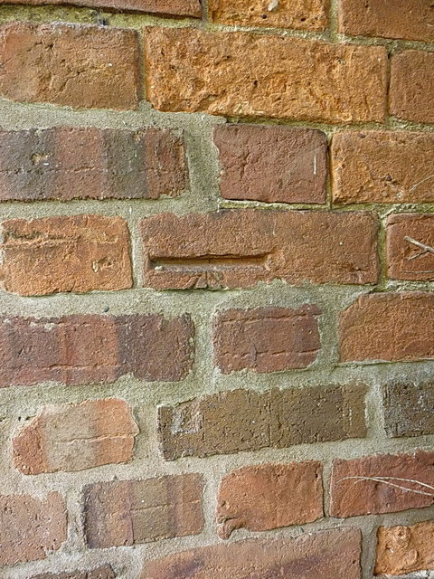
Image: © Richard Law Taken: 21 Jun 2014
The remains of an OS benchmark on the north-facing wall of the roadside cottage at Coley Mill. It's on the wall behind a large conifer tree, and not accessible without asking the owners nicely. The existence of the datum cut without the conventional three-line arrow below it rather suggests that this is a re-positioned brick, a theory which is supported by the new mortar & pointing around these half-dozen bricks, so it may not be in its original position of 70.058m above Ordnance Datum newlyn.
Images are licensed for reuse under creativecommons.org/licenses/by-sa/2.0
Image Location
Latitude
52.771637
Longitude
-2.325397