Sluice at the Downhill End
Introduction
The photograph on this page of Sluice at the Downhill End by Des Blenkinsopp as part of the Geograph project.
The Geograph project started in 2005 with the aim of publishing, organising and preserving representative images for every square kilometre of Great Britain, Ireland and the Isle of Man.

There are currently over 7.5m images from over 14,400 individuals and you can help contribute to the project by visiting https://www.geograph.org.uk
Sluice at the Downhill End
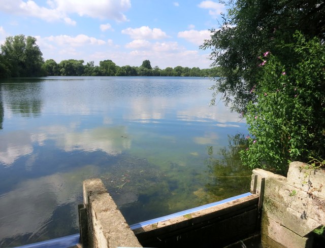
Image: © Des Blenkinsopp Taken: 22 Jul 2014
All these gravel pits follow the course of the River Windrush and so there is a natural gradient, in this case NW to SE. There is a flow through the lake system as there would be in a river, and levels are controlled by simple structures like this at the outfalls. For a rough idea of the gradient, the 75 metre contour passes the most northern lake, with a spot height of 66m at the south end. Not exact, but even a fall of 4 to 5 metres over around 4 km of lakes is more than enough to keep the water moving.
Images are licensed for reuse under creativecommons.org/licenses/by-sa/2.0
Image Location
Latitude
51.738797
Longitude
-1.426465