Local facilities at Caunton
Introduction
The photograph on this page of Local facilities at Caunton by Alan Murray-Rust as part of the Geograph project.
The Geograph project started in 2005 with the aim of publishing, organising and preserving representative images for every square kilometre of Great Britain, Ireland and the Isle of Man.

There are currently over 7.5m images from over 14,400 individuals and you can help contribute to the project by visiting https://www.geograph.org.uk
Local facilities at Caunton
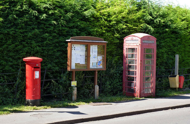
Image: © Alan Murray-Rust Taken: 24 Jul 2014
Postbox, village notice board and telephone kiosk. The kiosk still retains a telephone but is in need of a coat of paint. The postbox (ref NG23 119) is a standard GVIR pillar box. Fellow Geograph contributor Chris Downer informs me that this is an early version from this reign. It also seems that the postbox was only installed at this location following the closure of the local Post Office in the 1990s (the latter was situated across the Caunton Beck from the churchyard) so the GVIR cipher gives an entirely false indication of the date of installation.
Images are licensed for reuse under creativecommons.org/licenses/by-sa/2.0
Image Location
Latitude
53.13294
Longitude
-0.886587