Holtspur: The Church of St Thomas
Introduction
The photograph on this page of Holtspur: The Church of St Thomas by Nigel Cox as part of the Geograph project.
The Geograph project started in 2005 with the aim of publishing, organising and preserving representative images for every square kilometre of Great Britain, Ireland and the Isle of Man.

There are currently over 7.5m images from over 14,400 individuals and you can help contribute to the project by visiting https://www.geograph.org.uk
Holtspur: The Church of St Thomas
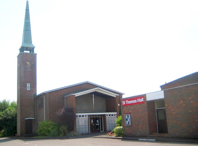
Image: © Nigel Cox Taken: 26 Jul 2014
With the post-war spread of Beaconsfield and the swallowing up of the hamlet of Holtspur the need for a church was perceived as urgent and a structure was first built here, on Mayflower Way, for that purpose in 1949. The present-day church building seen here dates from 1961. The site was once inside the curtilage of the old brick works that extended southwards to the road between London and Oxford. (Photographer's note. No amount of digital manipulation will turn this photo into anything worth looking at! It's the wrong view at the wrong time of day and in the worst lighting conditions. Apologies but at the time of writing it is the only photo of the church on the website.)
Images are licensed for reuse under creativecommons.org/licenses/by-sa/2.0
Image Location
Latitude
51.600995
Longitude
-0.666711