Roman fort wall, Vindolanda
Introduction
The photograph on this page of Roman fort wall, Vindolanda by Phil Champion as part of the Geograph project.
The Geograph project started in 2005 with the aim of publishing, organising and preserving representative images for every square kilometre of Great Britain, Ireland and the Isle of Man.

There are currently over 7.5m images from over 14,400 individuals and you can help contribute to the project by visiting https://www.geograph.org.uk
Roman fort wall, Vindolanda
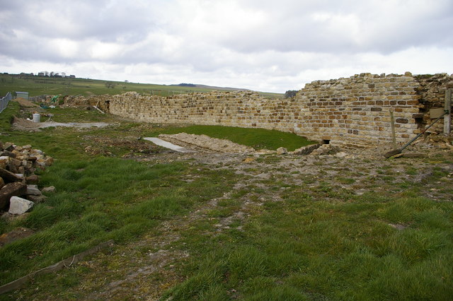
Image: © Phil Champion Taken: 8 Apr 2007
This section of the wall of the third stone fort was excavated during 2005 and is being consolidated for permanent display; the remains of two earlier fort walls were also excavated. the photo was taken from near the south west corner of the fort, looking to the west wall.
Images are licensed for reuse under creativecommons.org/licenses/by-sa/2.0
Image Location


Leaflet Map data © OpenStreetMap
Latitude
54.989852
Longitude
-2.360984