Holtspur: King's Head
Introduction
The photograph on this page of Holtspur: King's Head by Nigel Cox as part of the Geograph project.
The Geograph project started in 2005 with the aim of publishing, organising and preserving representative images for every square kilometre of Great Britain, Ireland and the Isle of Man.

There are currently over 7.5m images from over 14,400 individuals and you can help contribute to the project by visiting https://www.geograph.org.uk
Holtspur: King's Head
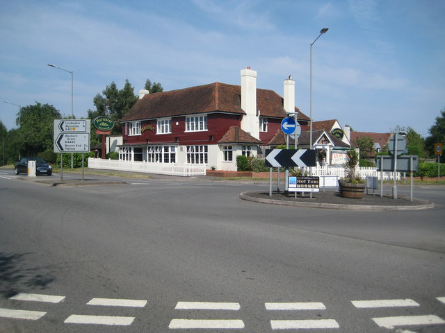
Image: © Nigel Cox Taken: 26 Jul 2014
Victorian Ordnance Survey maps show that Holtspur was then really not a lot more than the King's Head, presumably a coaching inn on the main route connecting London and Oxford, and a now long-lost brick works. Today the King's Head is a Harvester restaurant on the A40 (the Harvester Beaconsfield), but you would struggle to see evidence of its original name (it's there in red under the dark green oval Harvester sign, if you look closely, but sadly lacking the apostrophe). See http://www.harvester.co.uk/harvesterbeaconsfieldholtspur/ for details. Another sign of the times is the advert for hot tubs on the roundabout.
Images are licensed for reuse under creativecommons.org/licenses/by-sa/2.0
Image Location
Latitude
51.599683
Longitude
-0.669926