Looking east-southeast along the High Street
Introduction
The photograph on this page of Looking east-southeast along the High Street by John Baker as part of the Geograph project.
The Geograph project started in 2005 with the aim of publishing, organising and preserving representative images for every square kilometre of Great Britain, Ireland and the Isle of Man.

There are currently over 7.5m images from over 14,400 individuals and you can help contribute to the project by visiting https://www.geograph.org.uk
Looking east-southeast along the High Street
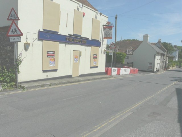
Image: © John Baker Taken: 13 Jul 2014
Boards have been placed over the windows and door of The Hope Inn while across the entrance to the carpark there are large red and white concrete blocks. Beyond them is Mayfield Cottage at 1 Sea Street, where alterations to this house are talking place; some scaffolding is just visible on the far left of the house. Planning permission has been granted by Dover District Council under application number DOV/11/00590 for the “erection of a rear conservatory and enlargement of rear window (existing conservatory to be demolished)”.
Images are licensed for reuse under creativecommons.org/licenses/by-sa/2.0
Image Location
Latitude
51.153239
Longitude
1.372771