Goods Depot at Tettenhall Station
Introduction
The photograph on this page of Goods Depot at Tettenhall Station by John M as part of the Geograph project.
The Geograph project started in 2005 with the aim of publishing, organising and preserving representative images for every square kilometre of Great Britain, Ireland and the Isle of Man.

There are currently over 7.5m images from over 14,400 individuals and you can help contribute to the project by visiting https://www.geograph.org.uk
Goods Depot at Tettenhall Station
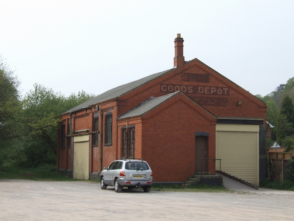
Image: © John M Taken: 21 Apr 2007
The 1920s Goods Depot stands in the corner of the car park for the Valley Park. The station closed in the 1960s. The line was used mainly for local goods and freight. During the second world war the line and station was used for the medical transfer of casualties.
Images are licensed for reuse under creativecommons.org/licenses/by-sa/2.0
Image Location
Latitude
52.596332
Longitude
-2.162351