Albert's Dock on the Chesterfield Canal
Introduction
The photograph on this page of Albert's Dock on the Chesterfield Canal by Neil Theasby as part of the Geograph project.
The Geograph project started in 2005 with the aim of publishing, organising and preserving representative images for every square kilometre of Great Britain, Ireland and the Isle of Man.

There are currently over 7.5m images from over 14,400 individuals and you can help contribute to the project by visiting https://www.geograph.org.uk
Albert's Dock on the Chesterfield Canal
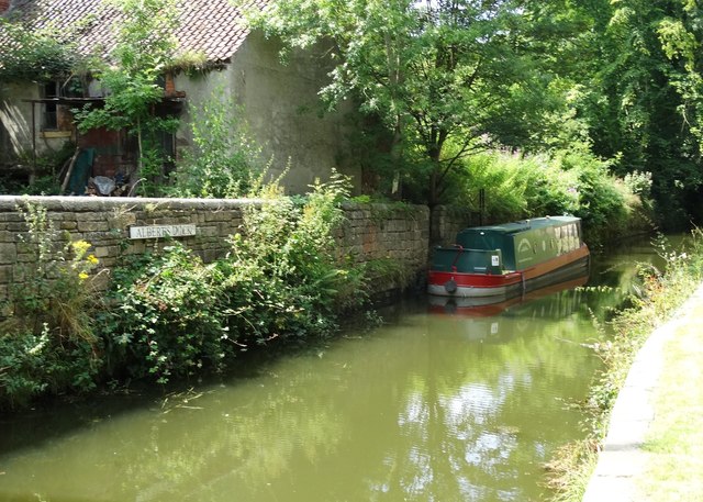
Image: © Neil Theasby Taken: 25 Jul 2014
It was from here that local stone began its long journey to London. It had been specially chosen for the construction of the Houses of Parliament. From here the stone was carried on barges to West Stockwith on the River Trent - thence to the River Humber - out into the North Sea then down the coast to The Thames. The journey usually took four days if winds were favourable.
Images are licensed for reuse under creativecommons.org/licenses/by-sa/2.0
Image Location
Latitude
53.33597
Longitude
-1.236028