Thomas Hardy House
Introduction
The photograph on this page of Thomas Hardy House by David P Howard as part of the Geograph project.
The Geograph project started in 2005 with the aim of publishing, organising and preserving representative images for every square kilometre of Great Britain, Ireland and the Isle of Man.

There are currently over 7.5m images from over 14,400 individuals and you can help contribute to the project by visiting https://www.geograph.org.uk
Thomas Hardy House
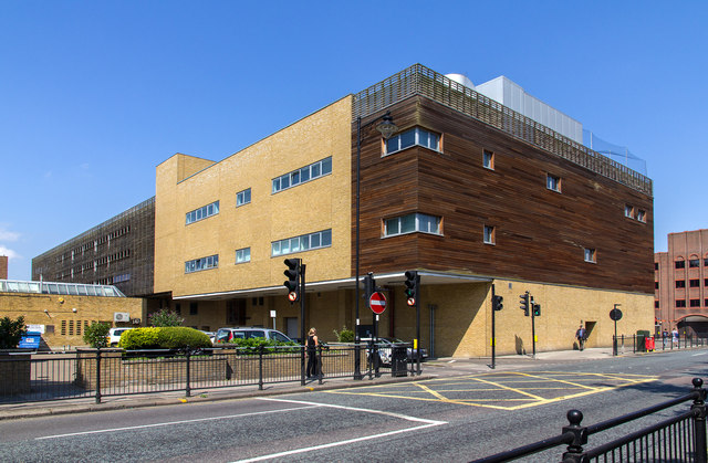
Image: © David P Howard Taken: 24 Jul 2014
A refurbished civic facility on the corner of London Road and Cecil Road. The project included Public areas located on the ground floor, consisting of a theatre/performance space and a public reception area and foyer, publicly accessible toilets and a cafeteria area, a Shopmobility area and an adjacent Workshop with reception opening onto Cecil Road. The building fit out project also originally provided for a temporary library and archive department on the first floor that was open to the public, pending relocation to the new central library building. The remainder of the building on the second and third floors was designed for general office space for the Council. http://www.frankham.com/projects/local-government/enfield-palace-exchange-civic-facility/
Images are licensed for reuse under creativecommons.org/licenses/by-sa/2.0
Image Location
Latitude
51.650066
Longitude
-0.080567