Caergwrle Drill Hall in High Street
Introduction
The photograph on this page of Caergwrle Drill Hall in High Street by John S Turner as part of the Geograph project.
The Geograph project started in 2005 with the aim of publishing, organising and preserving representative images for every square kilometre of Great Britain, Ireland and the Isle of Man.

There are currently over 7.5m images from over 14,400 individuals and you can help contribute to the project by visiting https://www.geograph.org.uk
Caergwrle Drill Hall in High Street
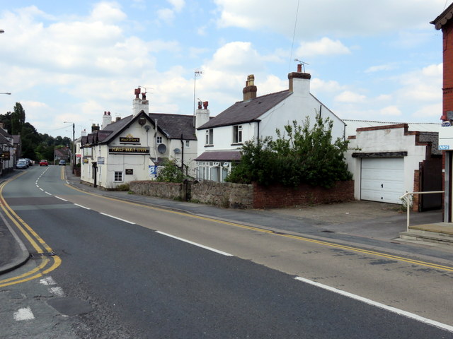
Image: © John S Turner Taken: 23 Jul 2014
The white house in the centre of the photo, and the long roof just visible beyond the garage, were built prior to 1899 as Caergwrle Drill Hall with accommodation. However, the garage wasn't built until after the 1912 O.S. map. In 2014 the house and garage were up for sale, whilst the drill hall behind is now Caergwrle Social Club. The brick walls and roof of the social club all look modern so it is unknown how much, if any, of the original hall is left. See also Image
Images are licensed for reuse under creativecommons.org/licenses/by-sa/2.0
Image Location
Latitude
53.110404
Longitude
-3.040294