New channel and bridges, Steeple Bumpstead
Introduction
The photograph on this page of New channel and bridges, Steeple Bumpstead by Hugh Venables as part of the Geograph project.
The Geograph project started in 2005 with the aim of publishing, organising and preserving representative images for every square kilometre of Great Britain, Ireland and the Isle of Man.

There are currently over 7.5m images from over 14,400 individuals and you can help contribute to the project by visiting https://www.geograph.org.uk
New channel and bridges, Steeple Bumpstead
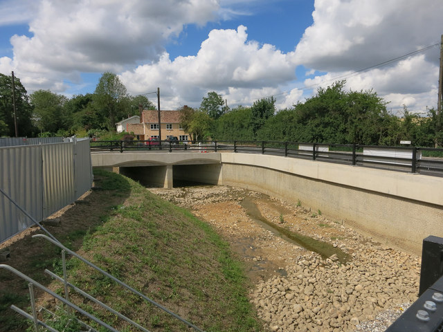
Image: © Hugh Venables Taken: 7 Jul 2014
Part of the £4 million Steeple Bumpstead Flood Alleviation Scheme. There are several new bridges required to remove restrictions on Helions Brook and Bumpstead Brook, hence the high cost. See Image for the reason why it is needed, the area also flooded in 2009. Image and Image show the ford that used to be here.
Images are licensed for reuse under creativecommons.org/licenses/by-sa/2.0
Image Location
Latitude
52.042476
Longitude
0.444109