Long Ridge
Introduction
The photograph on this page of Long Ridge by Simon Carey as part of the Geograph project.
The Geograph project started in 2005 with the aim of publishing, organising and preserving representative images for every square kilometre of Great Britain, Ireland and the Isle of Man.

There are currently over 7.5m images from over 14,400 individuals and you can help contribute to the project by visiting https://www.geograph.org.uk
Long Ridge
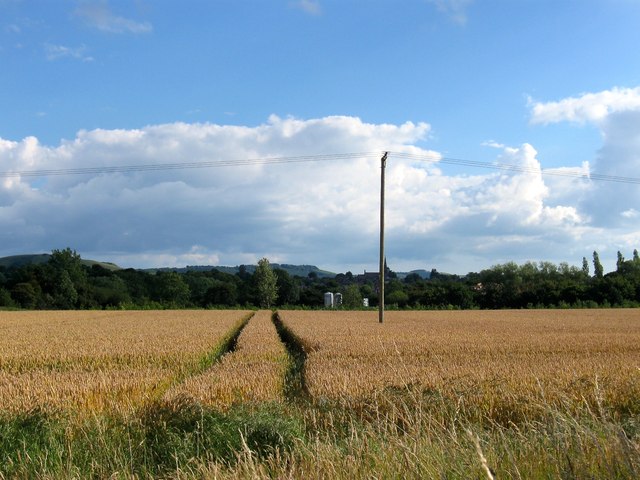
Image: © Simon Carey Taken: 13 Jul 2014
The name of the field according to Hurstpierpoint's 1842 tithe map that has been merged with Image to the west and south. The field originally occupied the north east corner of the current field. Beyond the hedgerow in the distance is evidence of a new development being built on a triangular plot of ground next to the junction of Cuckfield Road and Chalkers Lane. Partially obscured by the telegraph pole is the spire of Holy Trinity church beyond which to the left are Wolstonbury and Newtimber Hills.
Images are licensed for reuse under creativecommons.org/licenses/by-sa/2.0
Image Location
Latitude
50.945443
Longitude
-0.173937