Wellesley House, Manor Road, Hurstpierpoint
Introduction
The photograph on this page of Wellesley House, Manor Road, Hurstpierpoint by Simon Carey as part of the Geograph project.
The Geograph project started in 2005 with the aim of publishing, organising and preserving representative images for every square kilometre of Great Britain, Ireland and the Isle of Man.

There are currently over 7.5m images from over 14,400 individuals and you can help contribute to the project by visiting https://www.geograph.org.uk
Wellesley House, Manor Road, Hurstpierpoint
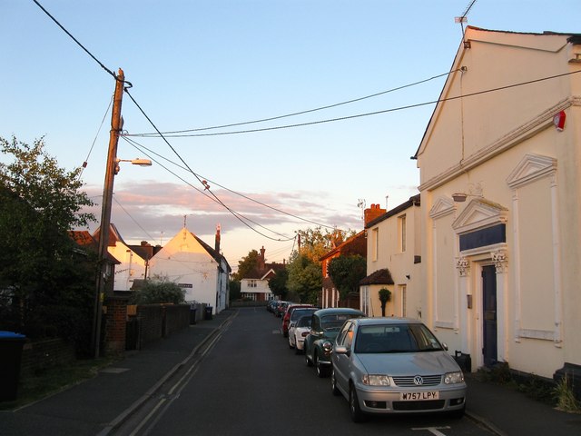
Image: © Simon Carey Taken: 6 Jul 2014
A former 19th century Wesleyan Chapel that was converted first to a club and more recently business premises. Further down the street are the former brewery premises now converted into residences.
Images are licensed for reuse under creativecommons.org/licenses/by-sa/2.0
Image Location
Latitude
50.934852
Longitude
-0.181041