Rock armour protecting Shore Road, Rostrevor
Introduction
The photograph on this page of Rock armour protecting Shore Road, Rostrevor by Eric Jones as part of the Geograph project.
The Geograph project started in 2005 with the aim of publishing, organising and preserving representative images for every square kilometre of Great Britain, Ireland and the Isle of Man.

There are currently over 7.5m images from over 14,400 individuals and you can help contribute to the project by visiting https://www.geograph.org.uk
Rock armour protecting Shore Road, Rostrevor
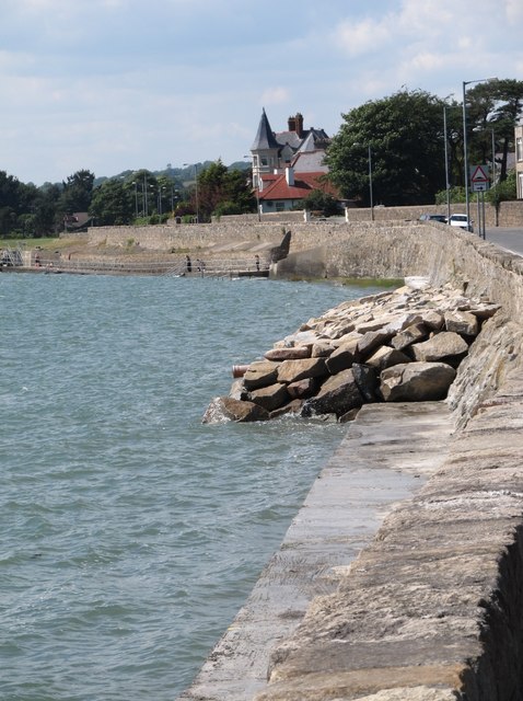
Image: © Eric Jones Taken: 1 Jul 2014
In January 2014 Shore Road and its westward continuation, Warrenpoint Road, were flooded by the sea and the sea wall breached at a number of points. The video on the link provides an idea of the seriousness of the flooding. http://www.bbc.co.uk/news/uk-northern-ireland-25604156
Images are licensed for reuse under creativecommons.org/licenses/by-sa/2.0
Image Location
Latitude
54.095423
Longitude
-6.193627