Undeveloped land, Broadmeadow industrial estate, Teignmouth
Introduction
The photograph on this page of Undeveloped land, Broadmeadow industrial estate, Teignmouth by Robin Stott as part of the Geograph project.
The Geograph project started in 2005 with the aim of publishing, organising and preserving representative images for every square kilometre of Great Britain, Ireland and the Isle of Man.

There are currently over 7.5m images from over 14,400 individuals and you can help contribute to the project by visiting https://www.geograph.org.uk
Undeveloped land, Broadmeadow industrial estate, Teignmouth
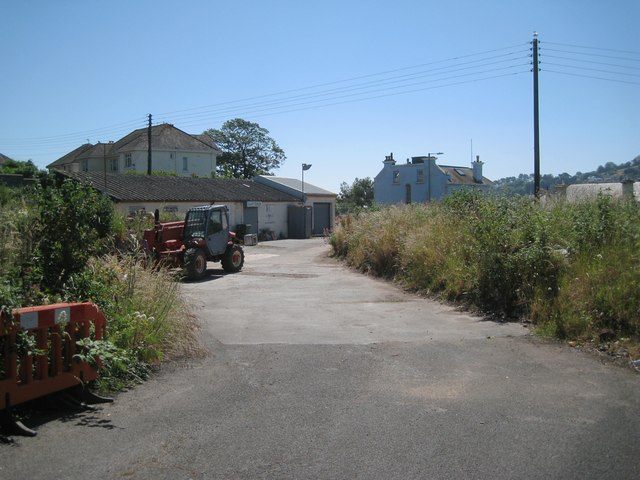
Image: © Robin Stott Taken: 6 Jul 2013
An aerial photograph suggests that this land has been used for tipping rubble. It was the site of first one gasholder before 1905, then two from before 1933, reducing to one in the 1970s. The gas works was on the land by the river that is now a private boat park. There is still a gas installation adjoining the road. The nearest house in the background, left, is 'Leaside', also seen in Image The blue-painted house right of centre (and across the main road) is called Cliff Park and is shown on the OS map of 1890. The roof to its left is that of Broadmeadow House, which first appears on the OS map of 1963.
Images are licensed for reuse under creativecommons.org/licenses/by-sa/2.0
Image Location
Latitude
50.546646
Longitude
-3.513673