Northampton University and old racecourse: aerial 2014
Introduction
The photograph on this page of Northampton University and old racecourse: aerial 2014 by Chris as part of the Geograph project.
The Geograph project started in 2005 with the aim of publishing, organising and preserving representative images for every square kilometre of Great Britain, Ireland and the Isle of Man.

There are currently over 7.5m images from over 14,400 individuals and you can help contribute to the project by visiting https://www.geograph.org.uk
Northampton University and old racecourse: aerial 2014
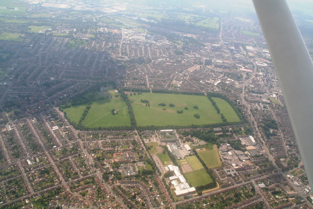
Image: © Chris Taken: 2 Jul 2014
St. Georges Avenue campus. The Racecourse comprises about 118 acres and is now a recreation ground. It once staged regular horse racing meetings, but these ceased in 1904 owing to the high accident rate due to the sharp turns on the course. Picture taken from about 3,000 ft by the "Child with the Dandelion Clock": Image
Images are licensed for reuse under creativecommons.org/licenses/by-sa/2.0
Image Location
Latitude
52.25113
Longitude
-0.889457