Bridleway and arch, Briary Hill, Dick Focks Common
Introduction
The photograph on this page of Bridleway and arch, Briary Hill, Dick Focks Common by Stefan Czapski as part of the Geograph project.
The Geograph project started in 2005 with the aim of publishing, organising and preserving representative images for every square kilometre of Great Britain, Ireland and the Isle of Man.

There are currently over 7.5m images from over 14,400 individuals and you can help contribute to the project by visiting https://www.geograph.org.uk
Bridleway and arch, Briary Hill, Dick Focks Common
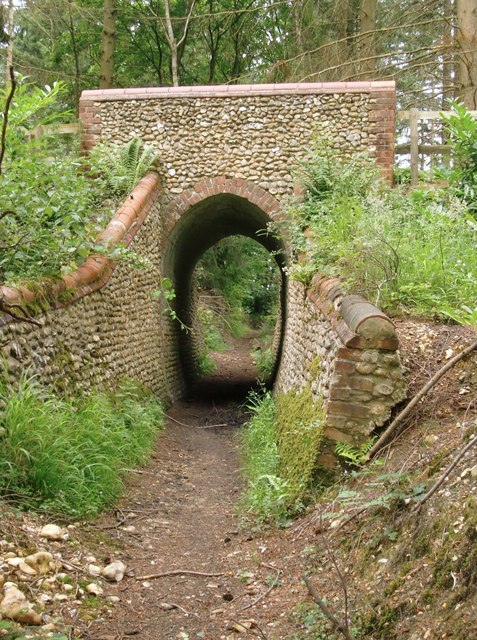
Image: © Stefan Czapski Taken: 30 Jun 2014
A closer view of the arch seen in Image As can be seen, the bridleway runs in a narrow trench a few feet below the local ground level. The arch itself is brick lined, whereas much of the structure is built of flint cobbles - whole flint nodules, unknapped. The bridge is known locally as Briary Hill East, and stands perhaps 120m east of the bridge shown in: http://www.geograph.org.uk/photo/4052543
Images are licensed for reuse under creativecommons.org/licenses/by-sa/2.0
Image Location
Latitude
51.245873
Longitude
-0.425842