Information board about a new Sainsbury?s store
Introduction
The photograph on this page of Information board about a new Sainsbury?s store by John Baker as part of the Geograph project.
The Geograph project started in 2005 with the aim of publishing, organising and preserving representative images for every square kilometre of Great Britain, Ireland and the Isle of Man.

There are currently over 7.5m images from over 14,400 individuals and you can help contribute to the project by visiting https://www.geograph.org.uk
Information board about a new Sainsbury?s store
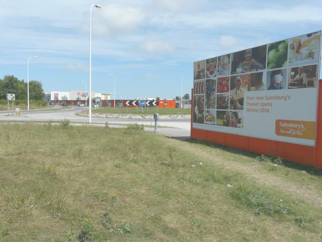
Image: © John Baker Taken: 22 Jun 2014
The board states that “your new Sainsbury’s Thanet opens winter 2014”. Planning permission has been granted by Thanet District Council under application number F/TH/12/0781 for the "erection of retail superstore (use Class A1) (approx 14,400 sqm GEA), petrol filling station and public open space with associated landscaping, servicing, car parking, access and link road, together with outline application for 1 and 2 storey buildings for non-food retail, restaurants and or take away uses (Use Classes A1, A3-A5) with associated parking and open space, following demolition of existing buildings". The location was described as “land and buildings south of Westwood Cross and between New Haine Road and Margate Road, Broadstairs”. It is an enormous site, some of which is hidden behind hoarding, beyond the roundabout, in this view. This is how Image looks now it has been completed.
Images are licensed for reuse under creativecommons.org/licenses/by-sa/2.0
Image Location
Latitude
51.354968
Longitude
1.392606