49 Bugle Street
Introduction
The photograph on this page of 49 Bugle Street by Alan Murray-Rust as part of the Geograph project.
The Geograph project started in 2005 with the aim of publishing, organising and preserving representative images for every square kilometre of Great Britain, Ireland and the Isle of Man.

There are currently over 7.5m images from over 14,400 individuals and you can help contribute to the project by visiting https://www.geograph.org.uk
49 Bugle Street
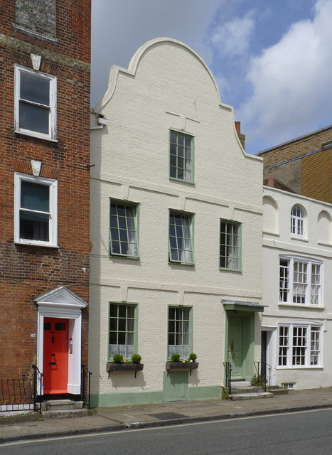
Image: © Alan Murray-Rust Taken: 28 Jun 2014
17th century town house with some 18th century alterations. The distinctive feature is the Dutch gable. Listed Grade II*. The 18th century front of the building to the right conceals a 16th century timber framed house, Listed Grade II.
Images are licensed for reuse under creativecommons.org/licenses/by-sa/2.0
Image Location
Latitude
50.899127
Longitude
-1.406121