Ruins of West Goldhill
Introduction
The photograph on this page of Ruins of West Goldhill by Robert Graham as part of the Geograph project.
The Geograph project started in 2005 with the aim of publishing, organising and preserving representative images for every square kilometre of Great Britain, Ireland and the Isle of Man.

There are currently over 7.5m images from over 14,400 individuals and you can help contribute to the project by visiting https://www.geograph.org.uk
Ruins of West Goldhill
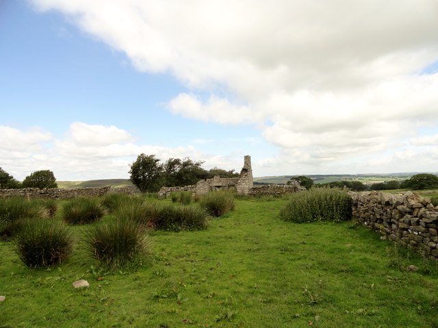
Image: © Robert Graham Taken: 18 Jun 2014
The ruins of this former farm lie a short distance west of the present Goldhill Farm, along the track to Carp Shield. The farm name is shown on the 1862 First Series Orddnance Survey map, when it was presumably still inhabited. Interestingly, the present farm is shown as East Goldhill.
Images are licensed for reuse under creativecommons.org/licenses/by-sa/2.0
Image Location
Latitude
54.823038
Longitude
-1.920749