Llanthony Secunda, Gloucester
Introduction
The photograph on this page of Llanthony Secunda, Gloucester by Philip Pankhurst as part of the Geograph project.
The Geograph project started in 2005 with the aim of publishing, organising and preserving representative images for every square kilometre of Great Britain, Ireland and the Isle of Man.

There are currently over 7.5m images from over 14,400 individuals and you can help contribute to the project by visiting https://www.geograph.org.uk
Llanthony Secunda, Gloucester
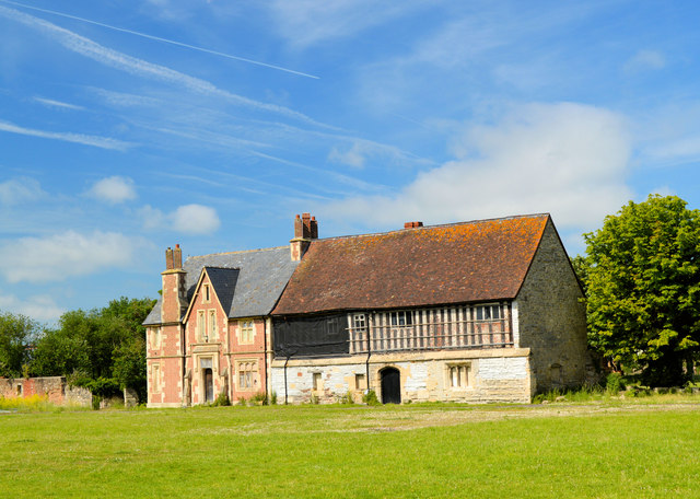
Image: © Philip Pankhurst Taken: 19 Jun 2014
Founded in 1136 by Miles of Gloucester for Augustinian canons fleeing from Llanthony Priory in the Black Mountains, which had been overrun by the Welsh. 'A splendid green oasis amidst seedy industrial development' says Pevsner, although in 2014 the green oasis is an unofficial playing field for neighbouring Gloucestershire College. A few scanty remains include this portion of the central range between the inner and outer courts. There is no sign of the magnificent abbey church.
Images are licensed for reuse under creativecommons.org/licenses/by-sa/2.0
Image Location
Latitude
51.859762
Longitude
-2.257552