Old Tarradale School
Introduction
The photograph on this page of Old Tarradale School by Richard Dorrell as part of the Geograph project.
The Geograph project started in 2005 with the aim of publishing, organising and preserving representative images for every square kilometre of Great Britain, Ireland and the Isle of Man.

There are currently over 7.5m images from over 14,400 individuals and you can help contribute to the project by visiting https://www.geograph.org.uk
Old Tarradale School
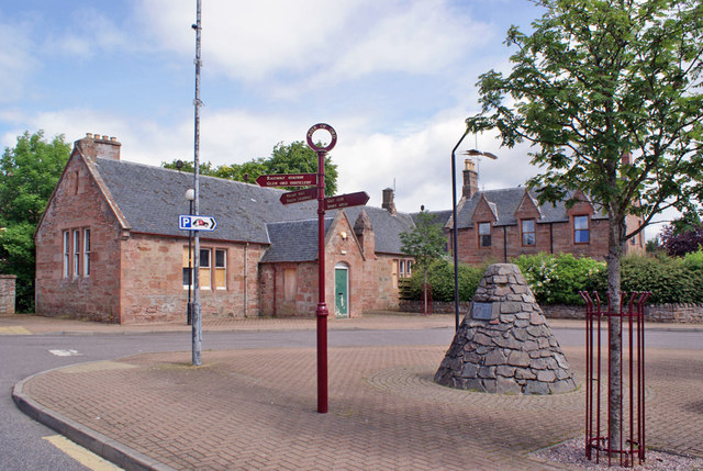
Image: © Richard Dorrell Taken: 17 Jun 2014
Located just off Tarradale Terrace, and facing a small car park (see Image]). The building dates from about 1875, and is the oldest surviving part of the old Board School. Since 2011, local community groups have been working with the aim of developing the old school building as a community hub incorporating a café, heritage/visitors centre and community meeting area. The cairn on the right marks the site of an ancient burial mound.
Images are licensed for reuse under creativecommons.org/licenses/by-sa/2.0
Image Location


Leaflet Map data © OpenStreetMap
Latitude
57.517089
Longitude
-4.458044