Sydenham Hill Station and Penge Tunnel, 1989
Introduction
The photograph on this page of Sydenham Hill Station and Penge Tunnel, 1989 by Ben Brooksbank as part of the Geograph project.
The Geograph project started in 2005 with the aim of publishing, organising and preserving representative images for every square kilometre of Great Britain, Ireland and the Isle of Man.

There are currently over 7.5m images from over 14,400 individuals and you can help contribute to the project by visiting https://www.geograph.org.uk
Sydenham Hill Station and Penge Tunnel, 1989
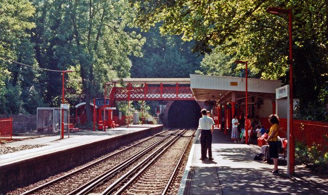
Image: © Ben Brooksbank Taken: 27 Jul 1989
View SE, towards Bromley South, Chatham, Faversham and Ramsgate/Dover: SE&CR London Victoria - Chatham - Kent Coast main line; local services also ran Holborn Viaduct (until 1987)/Blackfriars - Orpington. (A scene to remind me of the end of 10 years of commuting from here up to London).
Images are licensed for reuse under creativecommons.org/licenses/by-sa/2.0
Image Location
Latitude
51.432625
Longitude
-0.080487