Former Bond Street car park
Introduction
The photograph on this page of Former Bond Street car park by E Gammie as part of the Geograph project.
The Geograph project started in 2005 with the aim of publishing, organising and preserving representative images for every square kilometre of Great Britain, Ireland and the Isle of Man.

There are currently over 7.5m images from over 14,400 individuals and you can help contribute to the project by visiting https://www.geograph.org.uk
Former Bond Street car park
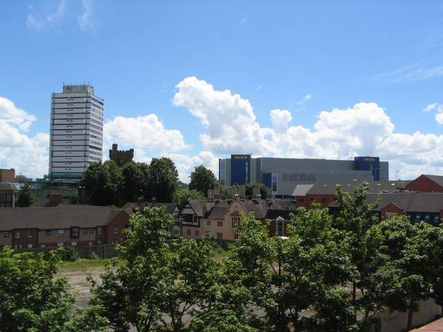
Image: © E Gammie Taken: 10 Jun 2014
The old Bond Street car park has been fenced off since at least 2007 (Image]) with no activity. Also visible around the car park are the Bond Street almshouses and old Bablake School and, in the background, Mercia House tower block, the tower of St John's church and the Ikea building.
Images are licensed for reuse under creativecommons.org/licenses/by-sa/2.0
Image Location
Latitude
52.409453
Longitude
-1.516011