South Street and Henhayes Lane, Crewkerne
Introduction
The photograph on this page of South Street and Henhayes Lane, Crewkerne by David Smith as part of the Geograph project.
The Geograph project started in 2005 with the aim of publishing, organising and preserving representative images for every square kilometre of Great Britain, Ireland and the Isle of Man.

There are currently over 7.5m images from over 14,400 individuals and you can help contribute to the project by visiting https://www.geograph.org.uk
South Street and Henhayes Lane, Crewkerne
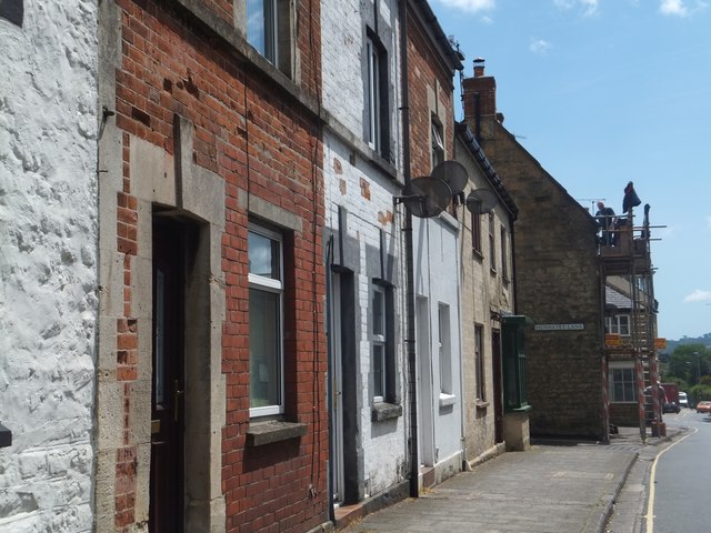
Image: © David Smith Taken: 5 Jun 2014
An assortment of facades lining the north side of South Street, some with the original Victorian brick and stone unpainted. The junction with Henhayes Lane is one place where a house juts out and the line of the road is irregular.
Images are licensed for reuse under creativecommons.org/licenses/by-sa/2.0
Image Location
Latitude
50.88256
Longitude
-2.793572