The Turnpike, Halam
Introduction
The photograph on this page of The Turnpike, Halam by Alan Murray-Rust as part of the Geograph project.
The Geograph project started in 2005 with the aim of publishing, organising and preserving representative images for every square kilometre of Great Britain, Ireland and the Isle of Man.

There are currently over 7.5m images from over 14,400 individuals and you can help contribute to the project by visiting https://www.geograph.org.uk
The Turnpike, Halam
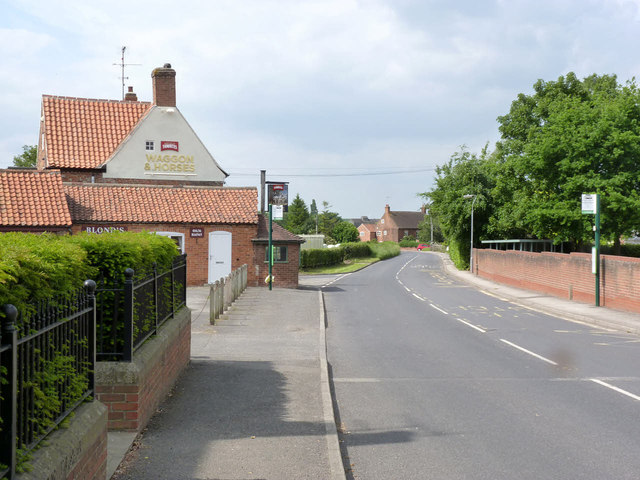
Image: © Alan Murray-Rust Taken: 1 Jun 2014
The roadname records the fact that this was a turnpike road, linking Mansfield with Leadenham to the east of Newark. On the left is the Waggon & Horses pub, dating from 1752 and Listed Grade II.
Images are licensed for reuse under creativecommons.org/licenses/by-sa/2.0
Image Location
Latitude
53.083875
Longitude
-0.989229