Bacon Lane
Introduction
The photograph on this page of Bacon Lane by Robin Webster as part of the Geograph project.
The Geograph project started in 2005 with the aim of publishing, organising and preserving representative images for every square kilometre of Great Britain, Ireland and the Isle of Man.

There are currently over 7.5m images from over 14,400 individuals and you can help contribute to the project by visiting https://www.geograph.org.uk
Bacon Lane
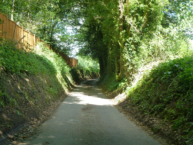
Image: © Robin Webster Taken: 8 Jun 2014
A sunken lane as it descends a hill, typical where there is sandstone geology. According to the Geology of Britain website, the geology here is "Bargate Sandstone Member - Sandstone. Sedimentary Bedrock formed approximately 112 to 125 million years ago in the Cretaceous Period. Local environment previously dominated by shallow seas."
Images are licensed for reuse under creativecommons.org/licenses/by-sa/2.0
Image Location
Latitude
51.133917
Longitude
-0.797264