Conduit House, Market Place
Introduction
The photograph on this page of Conduit House, Market Place by Roger Templeman as part of the Geograph project.
The Geograph project started in 2005 with the aim of publishing, organising and preserving representative images for every square kilometre of Great Britain, Ireland and the Isle of Man.

There are currently over 7.5m images from over 14,400 individuals and you can help contribute to the project by visiting https://www.geograph.org.uk
Conduit House, Market Place
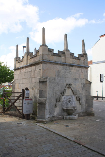
Image: © Roger Templeman Taken: 19 Apr 2014
Grantham's original conduit was a system built by the Greyfriars in around 1314. The underground lead pipes led from an intake house (said to have been demolished in 1979, but which is also recorded as being in ruins in 1987) which protected the spring three quarters of a mile west. After the Dissolution, the conduit system was extended from the friary site to the Market Place, where the small, highly decorated conduit house building still stands. No trace remains of the original lead pipeline or the iron pipe which replaced it later on. It was the first public water supply to the town. It was a public water supply from 1597 until 1851, but continued in use as a drinking fountain possibly until the late nineteenth century.
Images are licensed for reuse under creativecommons.org/licenses/by-sa/2.0
Image Location
Latitude
52.912967
Longitude
-0.644478