Rowleys House
Introduction
The photograph on this page of Rowleys House by Des Blenkinsopp as part of the Geograph project.
The Geograph project started in 2005 with the aim of publishing, organising and preserving representative images for every square kilometre of Great Britain, Ireland and the Isle of Man.

There are currently over 7.5m images from over 14,400 individuals and you can help contribute to the project by visiting https://www.geograph.org.uk
Rowleys House
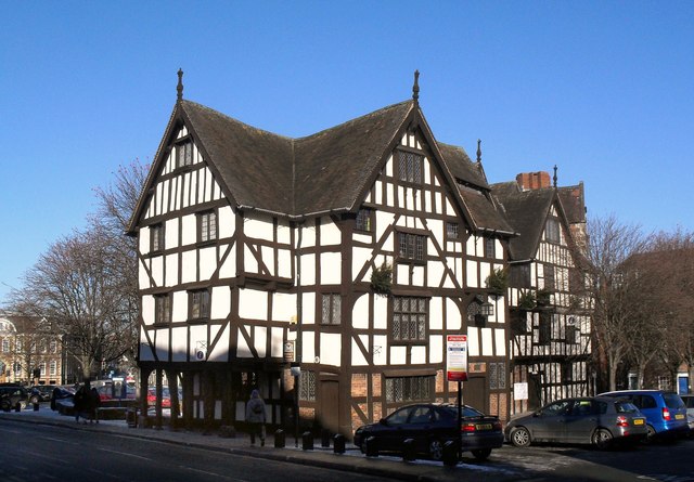
Image: © Des Blenkinsopp Taken: 28 Nov 2010
A 16th century building which was a museum when this picture was taken in 2010. This 2013 article from the Shropshire Star suggests that may no longer be the case. http://www.shropshirestar.com/news/2013/08/08/closure-date-for-shrewsbury-rowleys-house-museum/
Images are licensed for reuse under creativecommons.org/licenses/by-sa/2.0
Image Location
Latitude
52.708553
Longitude
-2.757178