The Blue Plaques of Christchurch: No. 11
Introduction
The photograph on this page of The Blue Plaques of Christchurch: No. 11 by Mike Searle as part of the Geograph project.
The Geograph project started in 2005 with the aim of publishing, organising and preserving representative images for every square kilometre of Great Britain, Ireland and the Isle of Man.

There are currently over 7.5m images from over 14,400 individuals and you can help contribute to the project by visiting https://www.geograph.org.uk
The Blue Plaques of Christchurch: No. 11
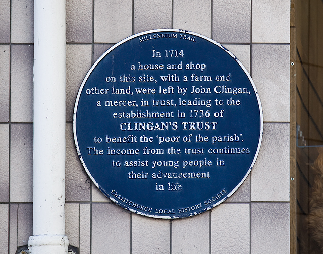
Image: © Mike Searle Taken: 18 May 2014
This plaque on the front of the present building (Bookends) in the High Street was built c.1900 on the site of Clingan House. This was a property left by John Clingan in 1714, that together with other property, provided income towards a charitable trust established in 1736 that continues to this day. Image
Images are licensed for reuse under creativecommons.org/licenses/by-sa/2.0
Image Location
Latitude
50.733701
Longitude
-1.776348