Severndroog Castle Vicinity, London SE18
Introduction
The photograph on this page of Severndroog Castle Vicinity, London SE18 by David Hallam-Jones as part of the Geograph project.
The Geograph project started in 2005 with the aim of publishing, organising and preserving representative images for every square kilometre of Great Britain, Ireland and the Isle of Man.

There are currently over 7.5m images from over 14,400 individuals and you can help contribute to the project by visiting https://www.geograph.org.uk
Severndroog Castle Vicinity, London SE18
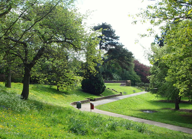
Image: © David Hallam-Jones Taken: 3 May 2014
250 metres north-east of Rose Cottage, a former park-keeper's cottage near Severndroog Castle, Stoney Alley (ahead) passes the rear of some gardens that once belonged to Jackwood House. The house, now demolished, was originally called "Jack’s Wood". Its name was later changed to "Mayfield" and finally to "Jackwood House". Apparently Viscount Folkestone succeeded to the Earldom of Radnor during his tenure of Jackwood House, hence the Latin inscription on the basin of a non-functioning fountain that can be seen on the terrace behind the benches ahead, that reads: "D.D. IACOBUS COMES DE RADNOR 1873". The rose gardens on the other side of the terrace looked well tended and the surrounding area seemed well maintained in this otherwise 'wooded-and-grassed' area.
Images are licensed for reuse under creativecommons.org/licenses/by-sa/2.0
Image Location
Latitude
51.465554
Longitude
0.061556