Development, Nine Elms Lane (1)
Introduction
The photograph on this page of Development, Nine Elms Lane (1) by Stephen Richards as part of the Geograph project.
The Geograph project started in 2005 with the aim of publishing, organising and preserving representative images for every square kilometre of Great Britain, Ireland and the Isle of Man.

There are currently over 7.5m images from over 14,400 individuals and you can help contribute to the project by visiting https://www.geograph.org.uk
Development, Nine Elms Lane (1)
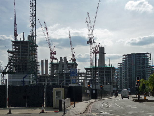
Image: © Stephen Richards Taken: 4 May 2014
Vauxhall's skyline currently resembles a world convention of cranes and is likely to continue to do so for some time. Cut through the marketing guff about creating new neighbourhoods (very few "ordinary" Londoners will be able to afford to live here) and the blather about transformation, and one is still left with an epic scale of development, spurred on by two things: a scheme for Battersea Power Station which actually appears to be viable, and the re-location of the new US Embassy (to somewhere towards the left of this photo). Seen here is a small slice of the total of twenty-plus different scheme across 195 hectares, the ouput of which will be 18,000 flats, a new pedestrian bridge across the Thames, extensions to the Northern Line, and, inescapably, "riverside shops, cafes, restaurants, art galleries, parks and public squares". On the left is Embassy Gardens (developers Ballymore Group). Further away on the right is Riverlight (developers St James Group Ltd).
Images are licensed for reuse under creativecommons.org/licenses/by-sa/2.0
Image Location
Latitude
51.482326
Longitude
-0.134426