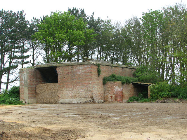
RAF Happisburgh Chain Home Low radar station
Introduction
The photograph on this page of RAF Happisburgh Chain Home Low radar station by Evelyn Simak as part of the Geograph project.
The Geograph project started in 2005 with the aim of publishing, organising and preserving representative images for every square kilometre of Great Britain, Ireland and the Isle of Man.
There are currently over 7.5m images from over 14,400 individuals and you can help contribute to the project by visiting https://www.geograph.org.uk

Image: © Evelyn Simak Taken: 30 Apr 2014
This is one of the two remaining buildings (Happisburgh One) of a temporary Chain Home Low radar station built at the end of 1939 to monitor shipping and aircraft. The station - co-located with a coastal gun battery > http://www.geograph.org.uk/photo/3956312 - consisted of a number of wooden huts, as well as a transmitter and a receiver block. These were surmounted by a wooden gantry carrying a turntable and an aerial system. The wooden posts seen lying on the roof of this building would seem to be the remains of such a gantry. The nearest stations were at West Beckham and at Stoke Holy Cross. The entrance to the site is guarded by a pillbox > http://www.geograph.org.uk/photo/3956226. The Chain Home (CH) and Chain Home Low (CHL) stations were designed primarily as early warning and raid reporting stations, however by the out break of the Second World War sector controllers were using CH data to position their fighters with an accuracy of about five miles. This was usually sufficient on a clear day or in bright moon light but useless in poor weather conditions or dark nights. It had been hoped that the development of air interception radar (AI) would have enabled fighters to complete the interception on their own, however the engineering problems encountered with the AI development were immense and it was clear that for the time being a method of ground controlled interception would have to be found. http://www.radarpages.co.uk/mob/chl/chl.htm

