Tynedale, Sitwell Street
Introduction
The photograph on this page of Tynedale, Sitwell Street by Christopher Hall as part of the Geograph project.
The Geograph project started in 2005 with the aim of publishing, organising and preserving representative images for every square kilometre of Great Britain, Ireland and the Isle of Man.

There are currently over 7.5m images from over 14,400 individuals and you can help contribute to the project by visiting https://www.geograph.org.uk
Tynedale, Sitwell Street
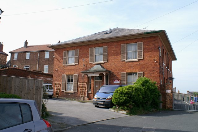
Image: © Christopher Hall Taken: 28 Apr 2014
This detached house of about 1860 was originally called the Red House.Lady Louisa Sitwell, who from 1870 lived at Wood End in The Crescent, was well known for her church and charitable work including the "Home of Hope", for destitute or fallen girls which was located in this house. It was called Tynedale by 1928 and by then the large grounds had been lost to houses in Sitwell Street and a laundry. It is now flats.
Images are licensed for reuse under creativecommons.org/licenses/by-sa/2.0
Image Location
Latitude
54.27786
Longitude
-0.416068