Rivet bench mark on wall
Introduction
The photograph on this page of Rivet bench mark on wall by Lairich Rig as part of the Geograph project.
The Geograph project started in 2005 with the aim of publishing, organising and preserving representative images for every square kilometre of Great Britain, Ireland and the Isle of Man.

There are currently over 7.5m images from over 14,400 individuals and you can help contribute to the project by visiting https://www.geograph.org.uk
Rivet bench mark on wall
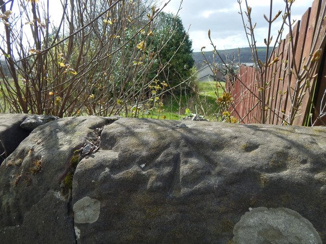
Image: © Lairich Rig Taken: 12 Apr 2014
The stone wall is alongside the pavement on the western side of Stirling Road. The same wall appears on the left in a picture of Image; from the point where that picture was taken, the bench mark is about 100 metres further along the wall. In the present picture, the wooden fence separates an area of housing (Strathleven Estate) from the meadow on the left, just as indicated on the map (the view direction for the picture was chosen to make this correspondence with the map easier to see). A rivet can be seen on the top of the wall, with an arrow-like cut mark pointing at it. According to the Ordnance Survey's own records, this third-order rivet bench mark is 36.023 metres above Newlyn Datum. The following description, written by another contributor, explains the terminology.
Images are licensed for reuse under creativecommons.org/licenses/by-sa/2.0
Image Location
Latitude
55.970851
Longitude
-4.565959